Photograph courtesy of Atlanta BeltLine
The Atlanta BeltLine is moving forward with projects to link together two of its key assets—the existing Westside Trail and what’ll eventually be Atlanta’s largest park—through several neighborhoods west of Midtown.
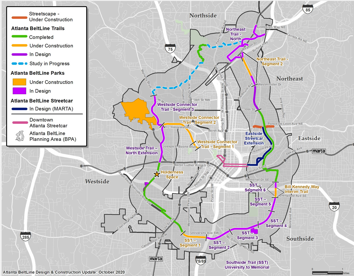
Three individual trail segments are now moving forward on the west side, with the goal of providing transportation and exercise options while connecting areas long divided by roadways, rail lines, or underused land. One of those—the Westside BeltLine Connector Trail, a partnership with the PATH Foundation that shoots like a three-mile spoke from downtown’s Centennial Olympic Park—is on pace to open for public use in a matter of weeks.
But the breaking news, as relayed during a Westside Study Group public meeting this week, is that the BeltLine section that now bends through neighborhoods such as Adair Park, West End, and Westview is making strides to become significantly longer. Exactly which route the Westside Trail might take as it grows toward the 22-mile loop’s eventual top end in Buckhead is becoming clearer, too.
Courtesy of Atlanta BeltLine
Declared an essential activity early in the COVID-19 pandemic, construction on BeltLine pieces from Piedmont Heights to Pittsburgh has continued largely unabated this year. In September, the BeltLine hired Alta Planning + Design to study how the Westside Trail might best be extended northward. The firm has drafted multimodal trail plans around the world and previously worked on projects in the area, including the Proctor Creek Greenway.
The Westside Trail’s northern terminus, as is, dead-ends west of Mercedes-Benz Stadium at 25-acre Washington Park, the centerpiece green space of a historic Black neighborhood of the same name. The BeltLine’s goal is to snake that trail northward for another 1.3 miles, to the doorstep of Westside Park at Bellwood Quarry, which is planned to one day dwarf Piedmont Park at 280 acres.
In a virtual meeting Monday, more than 100 participants Zoomed in from neighborhoods the new BeltLine sections would impact: Ashview Heights, Mozley Park, Hunter Hills, Bankhead, Vine City, Washington Park, Knight Park/Howell Station, English Avenue, Rockdale, and Grove Park, among others. During live polls conducted during presentations, a majority (33 percent) said they were most interested in using the BeltLine for exercise, followed by connectivity. Seventy-two percent of voters said they were generally excited by the plans presented—the others replying that more information is needed—though concerns did emerge about MARTA connectivity and new foot traffic on specific streets.
As outlined by Donny Donoghue, an Alta senior designer, the most feasible route of several considered would take the extended Westside Trail along the western edge of Washington Park, then pass through the park’s northern edge to cross an existing MARTA rail tunnel without the need for a new bridge.
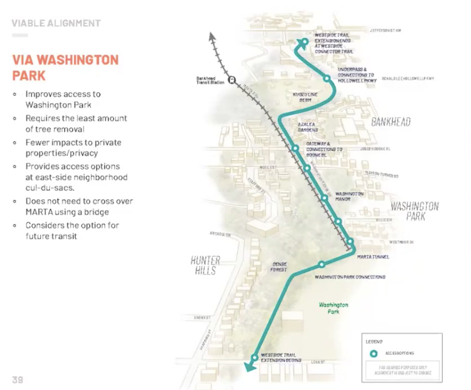
Courtesy of Atlanta BeltLine
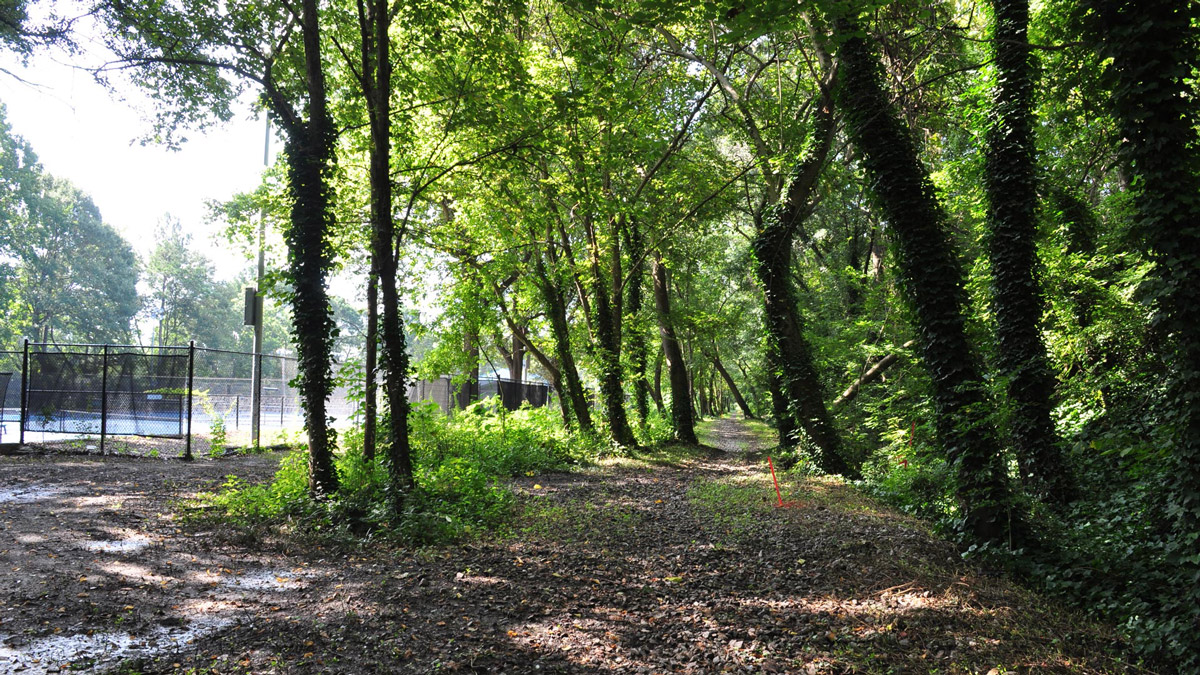
From there, it would link to existing cul-de-sac roads and cross busy Joseph E. Boone Boulevard with added safety features, including a possible “scramble crossing” that stops traffic in all directors for pedestrians and cyclists. Next it would enter an overgrown former railroad berm, the appropriately nicknamed “Kudzu Line,” elevated some 30 feet over surrounding areas with a skyline “viewshed” to the east. The goal, as Donoghue outlined, is to extract the kudzu and plant seasonal, flowering species as part of a “superbloom” scheme.
The final section would cross Donald Lee Hollowell Parkway via an underpass and tie into the aforementioned Connector Trail at a new plaza. Within a short walk of that point is the Proctor Creek Greenway and monumental quarry park project, where the first phase is nearing completion.
Like the rest of the Westside Trail, the extension would be 14-feet wide with lighting and security cameras installed before it opens.
In terms of next steps, Alta and BeltLine officials will continue vetting ideas and gathering community input, with hopes of finalizing construction documents and putting the extension out to bid in “shovel-ready” form in November 2021. Then, there’s the matter of money.
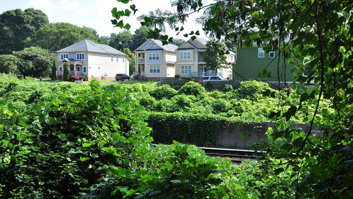
BeltLine spokesperson Jenny Odom says total costs of the Westside Trail extension have not been estimated, and funding sources have yet to be identified. It’s possible the corridor, in the meantime, will be opened as an interim trail, similar to the BeltLine’s crescent-shaped Southside Trail a couple of years ago.
Photograph courtesy of Atlanta BeltLine
For those with a fever for more BeltLine sooner, PATH Foundation executive director Greta deMayo says the Westside BeltLine Connector Trail will be open for public use by the end of 2020. It’ll begin kitty-corner to the Georgia World Congress Center and travel over three new bridges before passing through a tunnel at Donald Lee Hollowell Parkway in English Avenue.
Come January 1, as deMayo notes, PATH is set to break ground on another one-mile section of the Westside Trail’s mainline, continuing where the extension outlined above will eventually end.
That on-street project will reduce Marietta Boulevard to two travel lanes for vehicles, a center turn lane, and a 12-foot-wide multiuse trail buffered from traffic by an arboretum, all neighboring the quarry park. That work’s expected to wrap in about a year.